| Event | Date | Location | Magnitude |
|---|---|---|---|
| Recent Earthquake | July 15, 2024 | Somonauk, DeKalb County | 3.4 |
| Last Damaging Earthquake | June 1987 | Downstate Illinois | N/A |
| Strongest Earthquake in Northern Illinois | May 1909 | Lockport, Will County | 5.1 |
| Strongest Earthquake in Illinois | November 1968 | Norris City, Southeastern Illinois | 5.3 |
Introduction
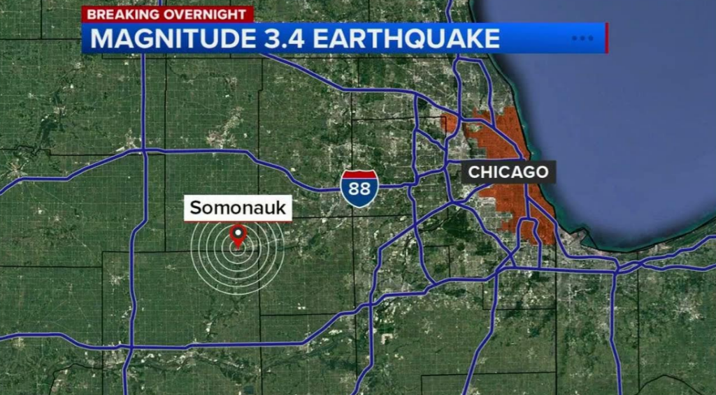
On Monday, July 15, 2024, a 3.4 magnitude earthquake struck near Somonauk, Illinois, in DeKalb County, approximately 60 miles west of Chicago. This event serves as a reminder that Illinois is not immune to seismic activity, despite being located in the Midwest. In this article, we will delve into the details of the recent earthquake, explore the seismic zones in Illinois, and discuss the state’s history of earthquakes.
The Recent Earthquake
The 3.4 magnitude earthquake occurred at 2:53 a.m. on Monday, with its epicenter about 2 kilometers northwest of Somonauk. While no significant damage was reported, residents in the western suburbs of Chicago, including Yorkville and Oswego, may have felt the quake. The DeKalb County Sheriff’s Office confirmed the event on Facebook, stating, “Information for those who were woken up a short time ago to your house shaking, there was just a 3.4 magnitude earthquake northwest of Somonauk”.
Seismic Zones in Illinois
Illinois is situated near two major seismic zones: the Wabash Valley Seismic Zone and the New Madrid Seismic Zone. The Wabash Valley Zone is located between southeastern Illinois and southwestern Indiana, while the New Madrid Zone spans across the Central Mississippi Valley, including parts of several states. There is a 25% to 40% chance of a magnitude 6.0 or greater earthquake occurring in the New Madrid Seismic Zone within any 50-year period.
Fault Lines in Northern Illinois
Contrary to popular belief, northern Illinois has several fault systems, including the Sandwich Fault Zone, which runs from DeKalb to Dixon, and the Peru Monocline, which runs southeast from Dixon across western LaSalle County. Additionally, there is a fault zone north of Chicago known as the Des Plaines Fault Zone, although it has not caused significant seismic activity.
History of Earthquakes in Illinois
Illinois experiences an average of five earthquakes per year. The strongest earthquake in the northern part of the state occurred in May 1909, with a magnitude of 5.1 in Lockport, Will County. The strongest earthquake ever recorded in Illinois was a 5.3-magnitude quake in November 1968, near Norris City in the southeastern part of the state.
Recent Earthquake History
- November 15, 2023: A 3.6 magnitude earthquake occurred in Standard, Putnam County, approximately 100 miles southwest of Chicago.
- June 17, 2021: A 3.8-magnitude earthquake in Indiana was felt by Chicago residents.
Conclusion
The recent 3.4 magnitude earthquake in DeKalb County serves as a reminder of Illinois’ seismic activity. Understanding the state’s fault lines and seismic zones is crucial for residents to be prepared for potential earthquakes. By staying informed, we can better respond to these events and minimize their impact on our communities.


