Introduction
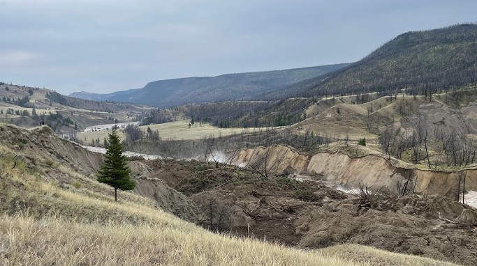
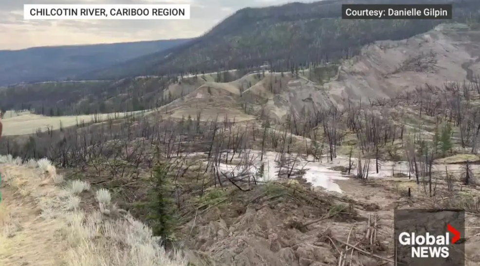
A significant landslide has blocked the Chilcotin River in British Columbia, Canada, causing widespread concern and ongoing monitoring by emergency management officials. The landslide, which occurred on July 30, 2024, has created a natural dam that is currently holding back a large volume of water. This article provides an update on the situation, including the latest developments, potential risks, and measures being taken to ensure public safety.
Key Facts and Figures
| Detail | Information |
|---|---|
| Location | Approximately 100 km southwest of Williams Lake, B.C. |
| Dimensions | 1,000 meters long, 100 meters wide, 30 meters deep |
| Water Rise Rate | 18-22 centimeters per hour |
| Potential Impact | Water could rise up to 21 meters at Farwell Canyon Bridge |
| Evacuation Order | In place for properties close to the river and slide zone |
| Monitoring | 24/7 monitoring by Emergency Management B.C. and external experts |
Current Situation
The landslide has created a significant blockage in the Chilcotin River, resulting in the formation of a large lake behind the dam. The water level behind the dam continues to rise at a rate of approximately 18-22 centimeters per hour. Despite some debris continuing to tumble down, the dam remains intact as of the latest updates.
Water Flow Predictions
- Best-Case Scenario: Water is expected to breach the dam slowly over 12 to 24 hours, resulting in flows below typical spring flooding peaks on the Fraser River but significantly higher on the Chilcotin River.
- Worst-Case Scenario: A rapid breach could occur within one hour, leading to a sudden and dangerous rise in water levels. This scenario could see the Chilcotin River rise by up to 21 meters at the Farwell Canyon Bridge and 12 meters where it meets the Fraser River.
Public Safety Measures
Given the potential risks, an evacuation order remains in place for properties near the river and slide zone. Residents are advised to stay away from the banks of both the Chilcotin and Fraser rivers. The Province is actively monitoring the situation and will continue to share updates as more information becomes available.
Risks and Concerns
- Further Landslides: There is a risk of additional landslides both upstream and downstream of the dam once water begins to flow past it.
- Fisheries Impact: The landslide poses a potential threat to spawning salmon and other fish species. Mitigation efforts are being planned in collaboration with First Nations and Fisheries and Oceans Canada.
Ongoing Monitoring and Response
The Province has set up a new web portal to share the latest information about the landslide with the public and media. This portal includes photos, videos, information bulletins, and mapping resources.
Real-Time Monitoring
Real-time water-level monitoring information is available through the Water Survey of Canada. The Province continues to conduct aerial survey flights and gather additional technical data to refine their models and prepare for all possible outcomes.
Conclusion
The Chilcotin River landslide remains a critical situation, with ongoing monitoring and planning to mitigate potential risks. The public is urged to stay informed through official channels and to follow all safety advisories to ensure their safety. As the situation evolves, updates will be provided to keep the public informed and safe.
