| Key Information | Details |
|---|---|
| Date | Saturday, June 22nd, 2024 |
| Magnitude | 6.2 |
| Epicenter | 93.9 kilometers west-northwest of Port of Spain, Trinidad and Tobago |
| Depth | 45.6 kilometers |
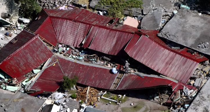
| Effects | Light to moderate shaking across Trinidad and Tobago, lasting approximately 30 to 35 seconds. Localized power outages in northwestern Trinidad. Felt reports from St. Lucia, St. Vincent and the Grenadines, Grenada, Trinidad and Tobago, northeastern Venezuela, Guyana, and French Guiana. |

Introduction
Trinidad and Tobago, two beautiful islands located in the southern Caribbean, are no strangers to seismic activity. On Saturday, June 22nd, 2024, the region was hit by a magnitude 6.2 earthquake, which struck 93.9 kilometers west-northwest of Port of Spain, Trinidad and Tobago, at a depth of 45.6 kilometers.
This event, while not as powerful as the magnitude 6.9 earthquake that occurred on August 21st, 2018, was still significant, with light to moderate shaking reported across the islands and felt as far north as St. Vincent and as far south as northeastern Guyana.
Seismic Zone One: A Complex and Active Area
Trinidad and Tobago are part of seismic zone one, a complex and highly active seismic area. This region is the second most seismically active area in the Eastern Caribbean, having generated major to great earthquakes in historic times. Some notable events include the magnitude 7.9 earthquake in 1766, which destroyed the then Capital of San José, and the magnitude 7.5 earthquake in 1888, which caused damage from Trinidad to St. Vincent.
The largest event for the instrumental period, i.e., since 1952, occurred on September 20th, 1968, and was of magnitude 7.0. Significant damage was caused in Venezuela, and Trinidad, where there was damage in Port of Spain.
Recent Seismic Activity in Trinidad and Tobago
The University of the West Indies Seismic Research Centre (UWI SRC) has recorded an annual average of 280 earthquakes in the Trinidad and Tobago region since 1990. Of these, 50 are typically above magnitude 3.5. Most earthquakes occur northwest of Trinidad in an area known as North of the Paria Peninsula, which has the second-highest seismicity in the Eastern Caribbean. Approximately 65 events of magnitude 2.1 and above are located in this area annually.
Elevated Seismic and Volcanic Activity
According to the UWI SRC’s annual report for 2020 to 2021, regional seismic and volcanic activity has been elevated for several years. On average, the Eastern Caribbean has seen a pattern of major (M7.0-M7.9) quakes every 20 to 30 years, and the last major (M7.0-7.9) quake occurred north of Martinique in 2007.
Historical patterns indicate that great quakes (M8.0+) on the Richter Scale have occurred every century in the region, with the last one taking place in 1843. While it is impossible to predict the exact time, date, magnitude, depth, etc., of an earthquake, it is crucial to be prepared for such events.
Preparing for Earthquakes
Given the region’s seismic activity, it is essential to be prepared for earthquakes. Knowing what to do during, before, and after an earthquake can help minimize damage and ensure safety. The UWI SRC provides resources and information on earthquake preparedness, which can be found on their website.

Conclusion
Trinidad and Tobago’s location in seismic zone one makes it prone to earthquakes. While the recent magnitude 6.2 earthquake did not cause significant damage, it serves as a reminder of the importance of being prepared for such events. By staying informed and following earthquake preparedness guidelines, residents can help ensure their safety and minimize the impact of future seismic events.

